creativecommons.org
A properly selected GPS guide for a driver and a tourist is a guarantee of saving time and a comfortable trip or hike. This device will drive you along the course in the minimum time, preventing you from getting into a possible traffic jam or lack of road in the direction of travel.
In order not to accidentally end up in the wrong place, it is important to understand how to choose a travel navigator. Such a question is a dilemma for an ordinary citizen, because on the Internet there are a lot of devices with their own positive and negative qualities, but I want to choose the best tourist navigator, and even for acceptable price. We decided to help in a difficult task and made our rating of navigators for a car and a tourist in 2021.
The content of the article
-
Which travel navigator is better to buy
- autonomy
- PC Compatibility
- The best navigator for car 2021
- The best gps navigator for tourism
- Budget device from the rating of navigators for tourism - it is worth your attention
Which travel navigator is better to buy
Before purchasing one of the navigators, you should indicate for yourself how long and in what situation the device will be used.
When buying a receiver, you should focus on some parameters:
- Receiver type. Devices from the rating of tourist navigators have a GPS receiver in their design, which allows you to find your coordinates even in a situation where it is impossible to see the surrounding area in detail or weather conditions do not allow conditions.
- Screen. The diagonal in almost all guidebooks is no different, and on some devices there is additional anti-reflective coating, which allows you to comfortably work with the device in bright sunlight.
- Availability of downloaded maps. According to this criterion, it is worth distributing all navigators into automobile, sea and topographic ones. The latter allow you to determine the route according to the terrain. They certainly belong to tourists, as they allow you to see the nearest trails without any problems and make a route in difficult terrain.
- Optional equipment. Basically, the set with the best navigator for tourism comes with a case that protects the display from scratches and scuffs. Also, some devices require a wire to connect to a computer. We will not even talk about fasteners - they are mandatory.
The interface of a modern navigator should have a sound accompaniment that notifies the motorist about the start of the route or approaching the finish point.
autonomy
creativecommons.org
The choice of a navigator for tourism or a car also provides for the operation of the device for a long time without recharging or with one power source. The ideal solution would be a combination of cord power and the ability to insert a battery in an emergency. Battery life should be at least 10 hours. The parameter is affected not only by the volume of the batteries, but also by the functionality of the equipment, which spends energy in different amounts, so look for a compromise.
PC Compatibility
For those who like to move along a pre-compiled route, you should definitely purchase a device with a connection to a PC. The fact is that any road can be pre-installed in a PC, and then transferred to the device’s memory in a few seconds. The connection can be either Bluetooth or USB.
The best navigator for car 2021
One of the main in the car guide segment is the navigator from Garmin GPSMAP 276Cx. The 5-inch color display is protected by durable glass. The model is assembled in such a way as to withstand maximum loads and possible mechanical damage. A lithium battery is responsible for the autonomy of the device, which supports the operation of the device for about 16 hours. Under the guide there is a compartment for batteries. Also, when the charge runs out, you can connect via USB 12V. The built-in antenna catches the signal both on the track and in hard-to-reach areas, and the set of settings resembles ERTF navigation charts. Even professional racers, in particular the KAMAZ-master team, use this navigator during their performances.
Among the advantages of the Garmin GPSMAP 276Cx model, there is a whole list of options, including: voice assistant, soundtrack, use of raster maps and much more. In addition, the instrument is configured for WAAS and EGNOS. Useful "chips": tide calculation, hunter's and fisherman's calendar.
The best gps navigator for tourism
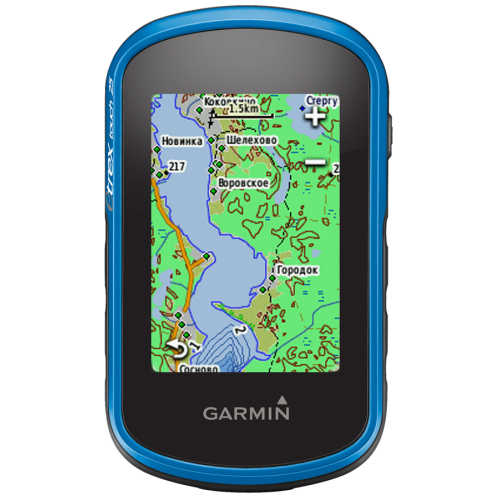
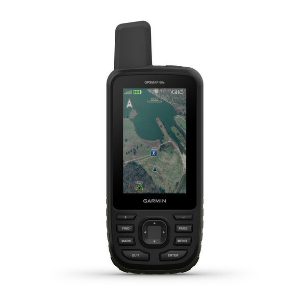
A miniature device with great functionality, the Garmin GPSMAP 64 ST is a great choice for an avid hiker who only walks through swamps and impenetrable forests. It has a bright display with anti-reflective coating. The guide is made for hiking: for this, the case is assembled from shock-resistant and resistant elements, it works without interference in the rain, the sensor is stable even when dropped from a height of 3-5 meters. In addition to touch control, the developers have inserted buttons into the device. The navigator received all the necessary functions, including: preloading maps, connecting sensors via ANT +, the presence of the BirdsEye service. A Bluetooth transmitter was even inserted into the device, so that you can connect to the phone.
The Garmin GPSMAP 64 ST model catches a satellite signal through the GLONASS and GPS systems with increased sensitivity. An antenna has been installed to amplify the signal. If it was not possible to establish a permanent connection, the tourist can navigate the terrain using the altimeter, barometer and compass, which are provided in the device.
Budget device from the rating of navigators for tourism - it is worth your attention
A small navigator Garmin eTrex 10 at a low cost has everything that any tourist needs. Differs in small dimensions and sensitivity, while it has a standard 2.2-inch monochrome screen. It is worth noting that the navigator should not be used in cold weather, as it reacts very poorly to sub-zero temperatures. The device is inexpensive, and therefore the control system is not the most convenient - the manufacturer did not provide for a lock against accidental pressing. There is a very good chance that after you take the guidebook out of your pocket, you will get a new route or stopover. The problem can be solved by purchasing a protective case.
Garmin eTrex 10 can use AA batteries for storage. The unit comes with a USB cable and a beginner's manual. The developers have built in support for WAAS and GLONASS, added the Track-Back option. When you turn it on for the first time, the downloaded maps will immediately appear - you don’t need to download anything extra.
